Woolshed Project
Overview
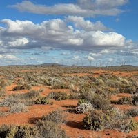
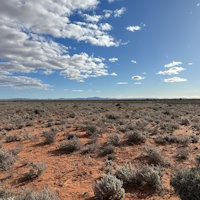
The Woolshed project comprises one exploration licence EL 6989 that contains two non-contiguous Blocks for a combined area of 87 square kilometres and is considered highly prospective for sedimentary-hosted roll-front and tabular-style uranium mineralisation, located in the south-eastern portion of the Frome Embayment, Southern Curnamona Province region of South Australia.
- The Northern Block contains a portion of the highly prospective Yarramba Palaeochannel and is situated 4km west of the Honeymoon Uranium Mine (36 Mlbs contained U3O8 )[1] and 4km west of the Jasons Uranium Deposit (11 Mlbs contained U3O8)[2] held by Boss Energy Ltd (ASX: BOE), (Figure 1).
- The Southern Block contains the headwaters of the Yarramba Palaeochannel situated directly on top of Mesoproterozoic granites and is contiguous with Orpheus’ Mundaerno project.
The Woolshed project is proximal to the radiogenic Honeymoon Granite that is considered the source of uranium in the area, including the Honeymoon Uranium Mine, Jasons Uranium Deposit and the Saffron Uranium Deposit (5.4Mlbs contained U3O8) held by Marmota Limited (ASX: MEU)[3], (Figure 1).
[1] Source: https://bossenergy.com/honeymoon-project
[2] Source: https://bossenergy.com/honeymoon-project/exploration
[3] Source: https://marmota.com.au/projects/uranium-projects/
Prospectivity
The Woolshed project contains evidence of surficial uranium anomalism visible in state-wide airborne radiometric imagery. This is highly encouraging as it confirms erosional processes of detrital material carrying radionuclides are shedding from the radiogenic Honeymoon Granite, along drainage tributaries directly across the Woolshed project in the direction of the Yarramba Palaeochannel, (Figure 2).
The location of the Yarramba Paleochannel has been recently revised by the Geological Survey of South Australia from Airborne Electromagnetic (AEM), the Frome TEMPESTTM AEM survey, that was flown in 2010 by Geoscience Australia, covering much of the Callabonna Sub-basin and a portion of the northern Murray Basin. AEM is an optimum geophysical technique at mapping paleodrainages in this region where thick sedimentary successions include stacked fluvial systems with channel sands saturated by variably saline groundwater[1].
Historically, the region was explored by the Minad-Teton joint venture as part of the South Eagle Uranium Project, leading to the discovery of Honeymoon in 1972.
One historic drillhole (K-26) located within EL 6989 (on the margin of the AEM inferred Yarramba Palaeochannel) and historic drillholes directly west of the licence boundary, intersected the prospective Namba and Eyre Formations containing: Tertiary (Cenozoic) sands including carbonaceous matter with lignite particles, considered a reductant to precipitate dissolved uranium from groundwaters. Drillhole K-26 penetrated Cenozoic sediments reaching 169m total depth[2], importantly, this confirms an established sedimentary sequence within EL 6989 Woolshed project, (Figure 2).
[1] Hou, B., Fabris, A.J., Michaelsen, B.H., Katona, L.F., Keeling, J.L., Stoian, L., Wilson, T.C., Fairclough, M.C., 2012. Paleodrainage and Cenozoic coastal barriers of South Australia: new map and GIS dataset, Geological Survey of South Australia, DMITRE
[2] Source: https://minerals.sarig.sa.gov.au/Details.aspx?DRILLHOLE_NO=144557
Geology
The Woolshed project is situated in the south-eastern portion of the Frome Embayment, Southern Curnamona Province comprising basement rocks of Proterozoic metasediment and metavolcanic units of the Willyama Supergroup and Mesoproterozoic granites of the Bimbowrie Suite, the Honeymoon Granite and Mundaerno Granite. Mesozoic and Cenozoic sediments were deposited unconformably with varying thickness on top of basement rocks and form paleochannel and blanket sands across the region, concealed at surface by younger Quaternary sediments.
Exploration
Orpheus’ exploration objective is to locate suitable trap sites for sedimentary-hosted roll-front and tabular-style uranium mineralisation within the Yarramba Palaeochannel and its tributaries back toward the source of the radiogenic Honeymoon Granite.
Orpheus exploration programs will involve:
- Review of historic passive seismic geophysical data and the recent acquisition of the Sentinel-2 Satellite Imagery and Thermal Analysis data that covers the Woolshed project.
- Geophysical surveys, geochemical sampling, and drilling within the Area of Interest of the inferred Yarramba Palaeochannel and its tributaries that shed directly from the radiogenic Honeymoon Granite.

Figure 1: Woolshed project location (EL 6989) and nearby uranium occurrences, highlighting the ‘Area of Interest’ within the Yarramba Palaeochannel, 4km west of the Honeymoon Uranium Mine and Jasons Uranium Deposit, and contiguous with Orpheus’ Mundaerno project (EL 6958)

Figure 2: Northern Block of the Woolshed project location EL 6989 and nearby uranium occurrences, highlighting evidence of shedding of radionuclides from the radiogenic Honeymoon Granite transgressing toward the Woolshed project and the Yarramba Palaeochannel, historic drillhole labels indicate depth of Cenozoic sediments to basement

URANIUM PROJECTS
South Australia
South Australia
South Australia
South Australia
South Australia
Northern Territory
South Australia
Australia & Zambia
South Australia and NT
